Queens Tornado Warning Lifts as Nor'easter Dumps 1.6 Inches of Rain
A wall cloud hovered over JFK Airport on Thursday, prompting emergency alerts and hail across southern Queens.
By Julian Schulz ·
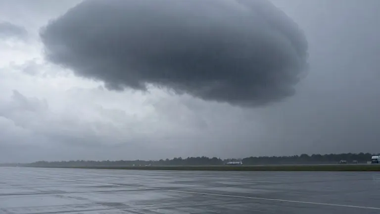
The National Weather Service issued a tornado warning for portions of southern Queens and southwestern Nassau County on Thursday. The alert remained active until 2 p.m. as a severe low-pressure system moved through the region.
Video footage captured a dark, rotating cloud formation known as a wall cloud dipping low near John F. Kennedy Airport. Bystanders observed the phenomenon from the ground, with one man noting the cloud was spinning over the water and moving toward land. No reports indicated the formation touched down on solid ground.
Rainfall in Central Park totaled more than 1.6 inches by Thursday. A flash flood warning was also in effect for southern Queens through 6:15 p.m. Hail pellets fell on a back porch in Far Rockaway during the afternoon, according to local video reports.
Precipitation is expected to continue on Friday. The National Weather Service forecasts an additional 0.3 to 1 inch of rain for the city. A few snowflakes are possible in the Bronx before rain tapers off by midday.
Colder air will follow the storm system. AccuWeather senior meteorologist Carl Erickson stated that the shift brings the season's coldest air so far. Overnight lows in the mid to high 30s Fahrenheit are projected for New York City and surrounding suburbs on Friday and Saturday. Gusty northwest winds will accompany the temperature drop.